


Buy this landscape artwork The dramatic landscape of Jan Mayen island by Anges van der Logt on canvas, ArtFrame, poster and wallpaper, printed on demand in high quality.
About "The dramatic landscape of Jan Mayen island"
by Anges van der Logt
About the artwork
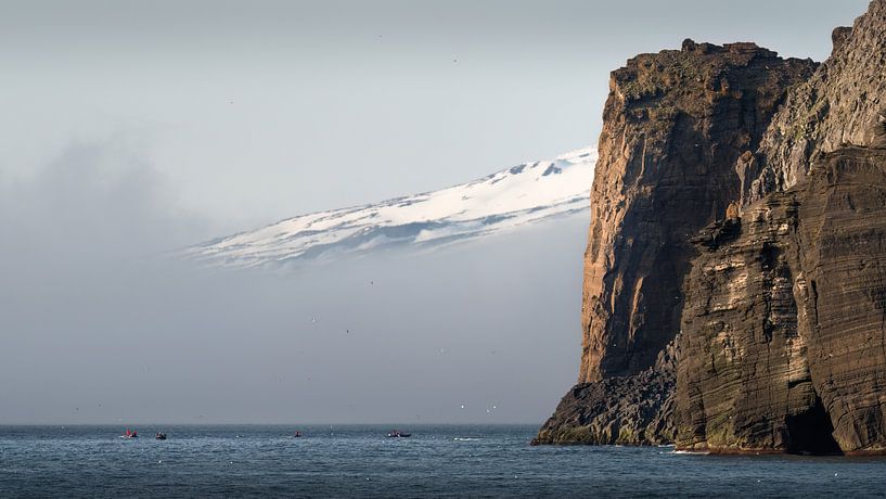
The dramatic landscape of Jan Mayen island. Jan Mayen is a Norwegian volcanic island in the Arctic Ocean. The island consists of two parts, connected by a narrow headland. It is partly covered by glaciers. The vegetation consists of simple tundra plants. The island lies 600 km northeast of Iceland between Greenland and northern Norway (71°N / 8°W). It is 373 km² in size, 54 km long and 2.5 to 15 km wide. Jan Mayen is enclosed between two seas. To the northwest is the Greenland Sea and to the southeast is the Norwegian Sea. The island's highest point, the Beerenberg volcano, is 2,277 metres high. This volcano was dormant for centuries, but became active again in 1970. On that occasion, the island grew by 3 square kilometres. Another eruption followed in 1985. The volcano has calmed down and one finds only some smoking fumaroles. Bear Mountain is the northernmost working volcano in the world. This is also one of the highest peaks in Norway.

About Anges van der Logt
A dutch photographer living in Jakarta, Indonesia since 1995. Specialized in landscapes and culture, mainly of Indonesia but also from other countries in Asia and elsewhere.
For examples you can have a look at my Instagram accounts: @angesvdl and @angesvdl.world..
Read more…
 Atlantic Ocean
 Landscapes
 North Sea
 Norway
 Oceans and seas
 Photo wallpaper
 Photography
 Powerful Expression
 Serene Peace
 Germany
 Ordered in March 2021
 Netherlands
 Ordered in August 2017
Germany
Ordered in August 2019
Germany
Ordered in October 2019
Germany
Ordered in April 2022
Germany
Ordered in February 2022
Germany
Ordered in October 2020
Germany
Ordered in July 2019
Germany
Ordered in April 2020
Netherlands
Ordered in December 2021
Netherlands
Ordered in August 2017
Germany
Ordered in August 2019
Germany
Ordered in October 2019
Germany
Ordered in April 2022
Germany
Ordered in February 2022
Germany
Ordered in October 2020
Germany
Ordered in July 2019
Germany
Ordered in April 2020
Netherlands
Ordered in December 2021
Netherlands Ordered in November 2019
Netherlands
Ordered in November 2022
Ordered in November 2019
Netherlands
Ordered in November 2022
About the material
ArtFrame™
Interchangeable Art Prints
- High-quality print
- Easily interchangeable
- Acoustic function
- Large sizes available


Discover the artworks of Anges van der Logt
 The gamelan maestro Ki Suripto on his gamelan in Salatiga, Central Java, IndonesiaAnges van der Logt
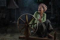 Old balinese woman with her spinning wheel in a small village near Ubud, Bali.Anges van der Logt
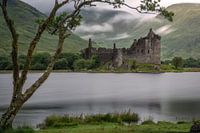 Kilchurn Castle on a quiet early morning in summerAnges van der Logt
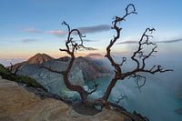 An old tree above the lake of the volcano Ijen in East JavaAnges van der Logt
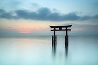 Torii gate at Lake Biwa in JapanAnges van der Logt
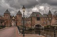 The Koppelpoort in Amersfoort on a rainy dayAnges van der Logt
 Javanese boy with his carrier pigeonsAnges van der Logt
 Help in the kitchenAnges van der Logt
 Sorting rice in the traditional wayAnges van der Logt
 I'm waiting for youAnges van der Logt
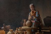 The potterAnges van der Logt
 Reading a book in the window frameAnges van der Logt
 Bike in the fogAnges van der Logt
 Fishing in the early morningAnges van der Logt
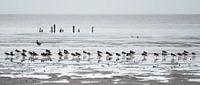 A flock of Oystercatchers on the beach near Paesens/ModdergatAnges van der Logt
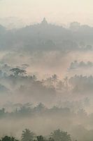 Borobudur in the morning mist (vertical)Anges van der Logt
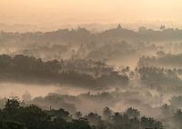 Borobudur temple during sunriseAnges van der Logt
 The footbridge in the forests of YakushimaAnges van der Logt
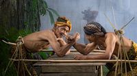 Two Javanese men in an arm fightAnges van der Logt
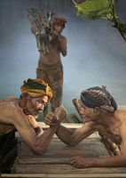 The arm fight in Central JavaAnges van der Logt


