


Buy Panoramic aerial view of the North Sea Canal by Maps Are Art on canvas, ArtFrame, poster and wallpaper, printed on demand in high quality.
About "Panoramic aerial view of the North Sea Canal"
by Maps Are Art
About the artwork
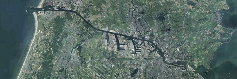
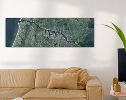
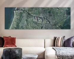
This is a panoramic image, excellent for wide walls. The source of this image is from the Land Registry's aerial photo dataset of the year 2017. It is a collage of Aerial photos that have been stitiched and post-processed in photoshop. As a result, it has a very high resolution and individual buildings are well visible.
The North Sea Canal is a canal in the Netherlands that connects The IJsselmeer with the North Sea. The canal runs from IJmuiden, a port city west of Amsterdam, to Amsterdam itself, where it serves the ports at Westpoort. The canal is about 25 km long and provides an important route for shipping traffic between the North Sea and inland waters. It is one of the busiest shipping routes in the world, with a large number of ships passing through the canal every day. The North Sea Canal is an important economic area, with many port facilities, shipyards and industries along its banks.

About Maps Are Art
Mapmaker, geography enthusiast, GIS expert and all-round creative... Read more…
 Amsterdam
 Drawings
 Haarlem
 IJmuiden
 North Sea
 Serene Peace
 Germany
 Ordered in February 2025
 Netherlands
 Ordered in May 2021
Netherlands
Ordered in March 2024
Netherlands
Ordered in May 2021
Netherlands
Ordered in March 2024
Netherlands Ordered in August 2022
Netherlands
Ordered in October 2021
Netherlands
Ordered in April 2021
Germany
Ordered in February 2024
Germany
Ordered in March 2021
Netherlands
Ordered in March 2020
Netherlands
Ordered in July 2023
Germany
Ordered in February 2024
Germany
Ordered in September 2020
Ordered in August 2022
Netherlands
Ordered in October 2021
Netherlands
Ordered in April 2021
Germany
Ordered in February 2024
Germany
Ordered in March 2021
Netherlands
Ordered in March 2020
Netherlands
Ordered in July 2023
Germany
Ordered in February 2024
Germany
Ordered in September 2020


About the material
Wallpaper
Make a statement with art on wallpaper
- Razor-sharp prints
- Easy to apply
- Big sizes possible
- Strong quality

Discover the artworks of Maps Are Art
 Map of Apeldoorn abstractMaps Are Art
 Map of Breda abstractMaps Are Art
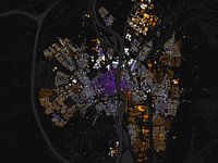 Map of Maastricht abstractMaps Are Art
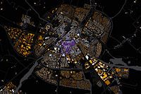 Map of Sneek abstractMaps Are Art
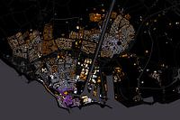 Map of Flushing abstractMaps Are Art
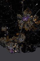 Abstract map Middelburg and VlissingenMaps Are Art
 Nijmegen Art Nouveau MapMaps Are Art
 Maastricht Art Nouveau MapMaps Are Art
 Eindhoven Art Nouveau MapMaps Are Art
 Arnhem Art Nouveau MapMaps Are Art
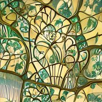 Urecht Jugendstil MapMaps Are Art
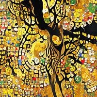 Map of Amsterdam in the style of Gustav KlimtMaps Are Art
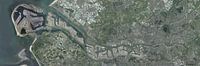 Panoramic aerial photo of Rotterdam EuropoortMaps Are Art
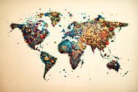 Vibrant world mapMaps Are Art
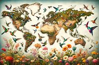 Bird World MapMaps Are Art
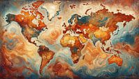 Van Gogh-style world mapMaps Are Art
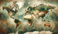 Impressionistic world map mer Wabi Sabi coloursMaps Are Art
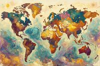 Colourful impressionist world mapMaps Are Art
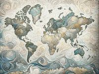 Impressionistic world map in light coloursMaps Are Art
 Impressionistic world map with intense colours.Maps Are Art


