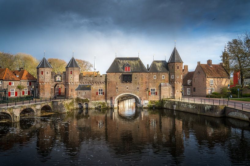


Buy the photo The Coupling Gate of Amersfoort in the evening with clouds by Bart Ros on canvas, ArtFrame, poster and wallpaper, printed on demand in high quality.
About "The Coupling Gate of Amersfoort in the evening with clouds"
by Bart Ros
About the artwork
The gate is located at the northwest side of the inner city, where the system of canals - fed by the Heiligenbergerbeek from the southern water gate Monnikendam - leaves the inner city and joins the Flierbeeksingel - the eastern remainder of the outer ring of canals (on the photo left) that originated from the Barneveldse Beek (formerly Flierbeek); the now filled in western part - called Beek in the Bekenstein area - used to run along what is now called the Stadsring (photo right) and originated from the Heiligenbergerbeek. After passing the (former) harbour area De Koppel the Valleikanaal, which was dug later, joins it - in turn fed by the Barneveldse Beek - and the whole of the waterways passes into the river Eem. The name Koppelpoort refers to the area outside the gate that was and is called De Koppel. The area served as common grazing land for, among others, the farms that came to lie within the walls after the construction of the second city wall.

About Bart Ros
I am a photographer and Multimedia engineer.
Originally I am a Multimedia engineer and designer, but since a few years I also try to put my Photography as a service on the market. From childhood I have always been busy drawing, painting, painting and disassembling Radios, TVs..
Read more…
 Amersfoort
 Architecture
 Church
 Photo wallpaper
 Photography
 Serene Peace
 Utrecht
 Water
Water Germany
 Ordered in March 2020
 Netherlands
 Ordered in August 2017
 Germany
Ordered in February 2025
Germany
Ordered in August 2019
Germany
Ordered in April 2021
Netherlands
Ordered in August 2022
Netherlands
Ordered in May 2021
Netherlands
Germany
Ordered in February 2025
Germany
Ordered in August 2019
Germany
Ordered in April 2021
Netherlands
Ordered in August 2022
Netherlands
Ordered in May 2021
Netherlands Ordered in May 2021
Germany
Ordered in January 2020
Netherlands
Ordered in January 2020
Germany
Ordered in January 2020
Germany
Ordered in November 2024
Ordered in May 2021
Germany
Ordered in January 2020
Netherlands
Ordered in January 2020
Germany
Ordered in January 2020
Germany
Ordered in November 2024
About the material
ArtFrame™
Interchangeable Art Prints
- High-quality print
- Easily interchangeable
- Acoustic function
- Large sizes available


Discover the artworks of Bart Ros
 Clouds above city view of Deventer and the Welle with reflection and traffic.Bart Ros
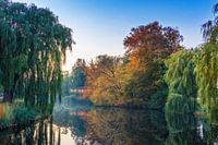 Deventer bird island in autumn colours with reflection in the water.Bart Ros
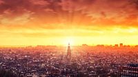 Setting sun over Amsterdam taken from Amsterdam LookoutBart Ros
 Streetlights in the streets of Amersfoort standing.Bart Ros
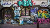 Graffiti on the walls of the Red Light District in AmsterdamBart Ros
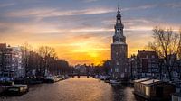 The Montelbaanstoren in Amsterdam during the sunsetBart Ros
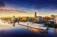 View of Arnhem from the John Frost Bridge with boats in the foreground.Bart Ros
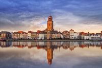 View of Deventer in pastel shades with reflection.Bart Ros
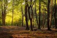 Trees in the Speulderbos near Ermelo NetherlandsBart Ros
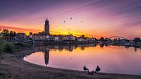 Hot air balloons over Deventer and the IJssel in OverijsselBart Ros
 path through the forest on the Heide in HilversumBart Ros
 Zutphen's downtown and St. Walburgis Church.Bart Ros
 Sun on Walstraat in Deventer Overijssel during Summer.Bart Ros
 Zwolle Overijssel square during sunsetBart Ros
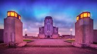 Radiocoting district during the blue hour with lighting.Bart Ros
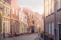 Sun-drenched charm: De Roggestraat in DeventerBart Ros
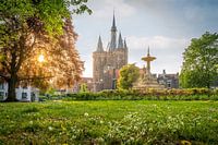 Sunlight play at the Sassenpoort in ZwolleBart Ros
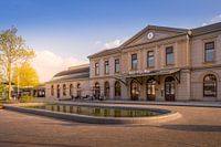 Sunlight on Zwolle's Renewed StationBart Ros
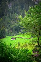 Yellow Flash: Train journey through Lauterbrunnens Natural BeautyBart Ros
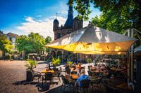 Summer Relaxation: terrace in front of the Waag in DeventerBart Ros


