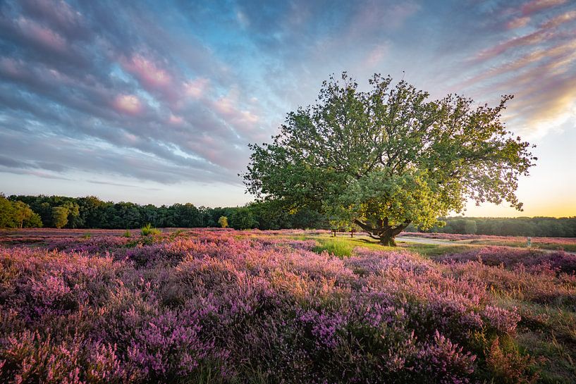


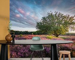
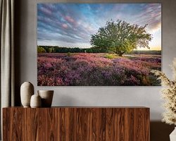


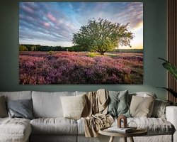
Buy this landscape artwork Table Mountain Heath by Tashina van Zwam on canvas, ArtFrame, poster and wallpaper, printed on demand in high quality.
About "Table Mountain Heath"
by Tashina van Zwam
About the artwork
Table Mountain Heath is a high-altitude heathland area between Huizen and Laren of about 74 ha located in the municipality of Huizen. The southern edge of the heath is in the municipality of Blaricum. The area is under the management of the Goois Natuurreservaat. Southwards, on the other side of the Oude Naarderweg, the Tafelbergerheide merges into the Blaricummerheide.
The heathland has many height differences, caused by the land ice during the Ice Age. The highest point is Table Mountain, from which this heath owes its name. This 36.4-metre-high 'hill' is one of the highest points in the province of North Holland. It takes its name from an old orientation table that was located on this slope. Part of it is still on display at the Museum Hilversum. A new orientation table was installed when Table Mountain was renovated in 2019.
Many clay pits are found on the heathland. These are the result of activities of former inhabitants of Het Gooi who took clay from this place, which they used to harden the floors and yards of their farms. The clay originates from northern Europe and was transported with the glacial ice during the rift ice age. The loam pits are very valuable because of the plant life unique to the Netherlands that can be found there.
Since 1990, Drentse heath sheep have been grazing on Tafelbergheide; cattle were added in 1991. Dogs are only allowed to walk on a leash in the grazed area.

About Tashina van Zwam
A very enthusiastic and passionate photographer from the Netherlands... Read more…
 Architecture
 Clouds
 Elegant Expressions
 Gentle Whispers
 Heath
Heath Landscapes
 Photo wallpaper
 Photography
 Serene Peace
 Summer
 Sun
Sun Sunset
 The Netherlands
 Trees
Trees Vibrant Colors
 Netherlands
 Ordered in January 2022
Netherlands
Ordered in September 2017
Netherlands
Ordered in November 2020
Ordered in January 2022
Netherlands
Ordered in September 2017
Netherlands
Ordered in November 2020
 Germany
 Ordered in May 2021
Germany
Ordered in March 2024
Netherlands
Ordered in April 2018
Netherlands
Ordered in October 2019
Netherlands
Ordered in November 2019
Netherlands
Ordered in December 2018
Netherlands
Ordered in May 2021
Germany
Ordered in March 2024
Netherlands
Ordered in April 2018
Netherlands
Ordered in October 2019
Netherlands
Ordered in November 2019
Netherlands
Ordered in December 2018
Netherlands Ordered in August 2022
Germany
Ordered in January 2022
Netherlands
Ordered in November 2021
Ordered in August 2022
Germany
Ordered in January 2022
Netherlands
Ordered in November 2021
About the material
ArtFrame™
Interchangeable Art Prints
- High-quality print
- Easily interchangeable
- Acoustic function
- Large sizes available


Discover the artworks of Tashina van Zwam
 Nature's GiftTashina van Zwam
 TogetherTashina van Zwam
 SleepyheadTashina van Zwam
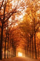 Autumn lightTashina van Zwam
 Red petalsTashina van Zwam
 White flowerTashina van Zwam
 Apache JunctionTashina van Zwam
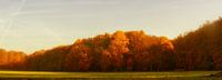 The forest edgeTashina van Zwam
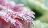 Water dropsTashina van Zwam
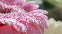 Bij elkaarTashina van Zwam
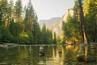 Yosemite National ParkTashina van Zwam
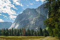 Yosemite National ParkTashina van Zwam
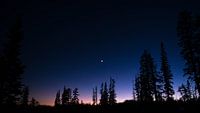 SunsetTashina van Zwam
 Groeneveld CastleTashina van Zwam
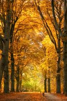 Follow the TrailTashina van Zwam
 Into the LightTashina van Zwam
 Timothy LakeTashina van Zwam
 Pirate's Cove BeachTashina van Zwam
 Multnomah FallsTashina van Zwam
 Multnomah FallsTashina van Zwam


