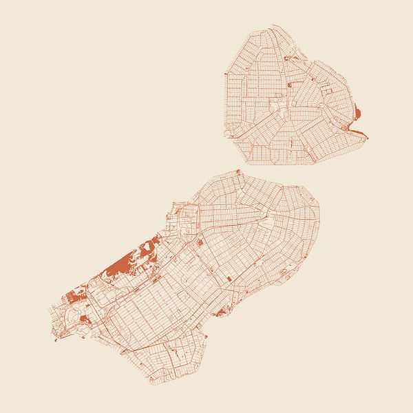


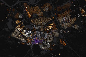
About ‘Waters of Flevoland’ by Maps Are Art
All the lakes, rivers, canals, streams, ditches and other watercourses of Flevoland province are depicted on this high-detail yet minimalist map. This is why it is not a land map but a water map. One of the great things about this type of map is that by showing only the water, other objects on land such as forests, towns and polders…
Colors
Discover our ArtFrame
The modern canvas alternative
Your chosen art on a textile print, stretched in an aluminum or wooden frame. Quick and easy to change for a fresh look and exactly as you want it.
- High-quality print
- Easily replaceable
- Acoustic function
- Large formats possible

Discover the artworks of Maps Are Art


Customer reviews
4.8/5

Related collections