


Buy this illustration Vintage map Hungary and Galicia by Studio Wunderkammer on canvas, ArtFrame, poster and wallpaper, printed on demand in high quality.
About "Vintage map Hungary and Galicia"
by Studio Wunderkammer
About the artwork
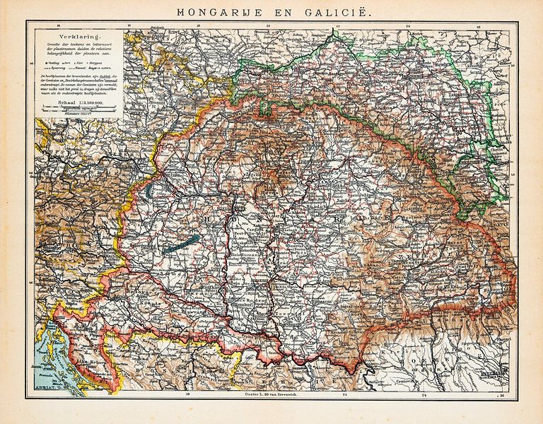
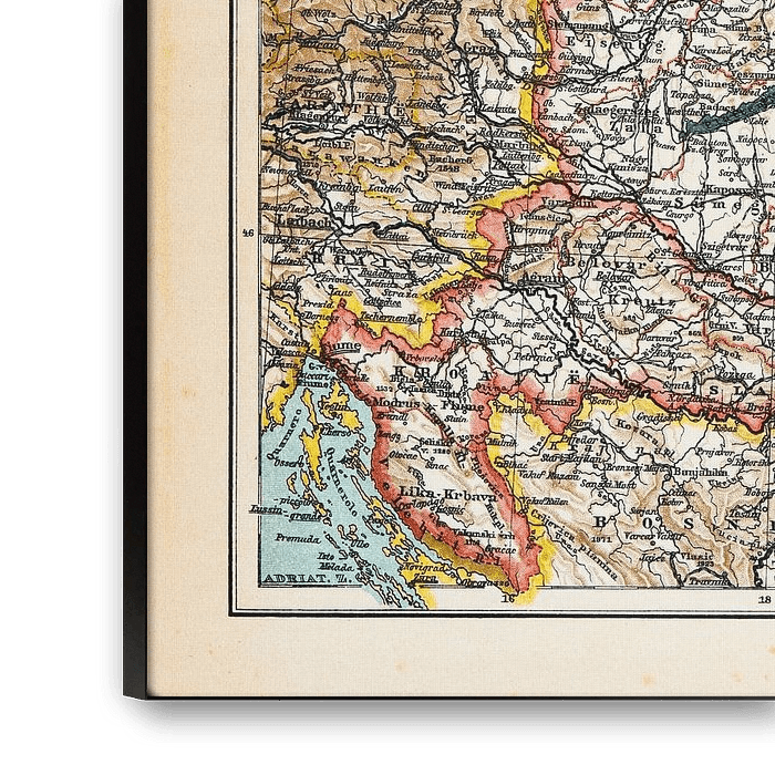
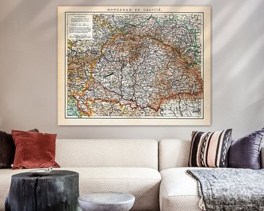
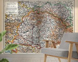
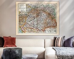
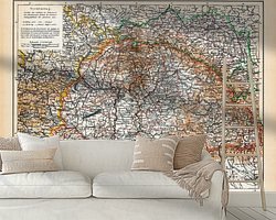
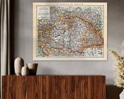
An ancient map from around 1900 depicting and then territory of Hungary and central European Galicia. Galicia is a historic tract of land on the northern slopes and foreland of the Carpathians belonging to Poland and Ukraine. It is bordered by the Beskids (south), the Vistula (northwest), the line between the mouth of the San and the source of the Zbroch (north), and finally the rivers Zbroch, Dniester and Cheremosh (southeast). The largest cities are Lviv and Kraków. The eastern part of Galicia, (Soviet) Ukrainian since 1945, is also known as Ruthenia. This map is in colour.

About Studio Wunderkammer
At Studio Wunderkammer, we are captivated by the vintage atmosphere of the Wunderkammer or cabinet of curiosities. A room in which the wonders of the natural world were brought together. Think of a collection consisting of taxidermy, fossils, insects, flora, fauna and scientific instruments. Basically.. Read more…
 Hungary
 Illustrations
 World and country maps
 Germany
 Ordered in January 2022
Germany
Ordered in September 2023
Ordered in January 2022
Germany
Ordered in September 2023
 Netherlands
 Ordered in April 2021
Netherlands
Ordered in April 2021
Netherlands Ordered in December 2020
Germany
Ordered in March 2020
Netherlands
Ordered in April 2019
Ordered in December 2020
Germany
Ordered in March 2020
Netherlands
Ordered in April 2019
 Germany
Ordered in June 2019
Netherlands
Ordered in December 2021
Germany
Ordered in November 2020
Netherlands
Ordered in April 2023
Netherlands
Ordered in November 2018
Netherlands
Ordered in December 2019
Germany
Ordered in June 2019
Netherlands
Ordered in December 2021
Germany
Ordered in November 2020
Netherlands
Ordered in April 2023
Netherlands
Ordered in November 2018
Netherlands
Ordered in December 2019
About the material
ArtFrame™
Interchangeable Art Prints
- High-quality print
- Easily interchangeable
- Acoustic function
- Large sizes available


Discover the artworks of Studio Wunderkammer
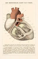 Anatomy. The human heart from the front.Studio Wunderkammer
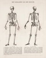 Anatomy. The skeleton of manStudio Wunderkammer
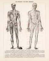 Human body. Human musclesStudio Wunderkammer
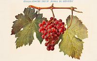 Antique colour plate with Italian grapeStudio Wunderkammer
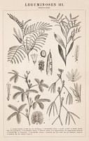 Botanical print Leguminosae IIIStudio Wunderkammer
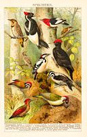 Antique colour lithograph Woodpeckers.Studio Wunderkammer
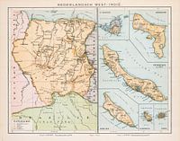 Vintage map Dutch West IndiesStudio Wunderkammer
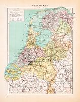 Vintage map Netherlands StatisticalStudio Wunderkammer
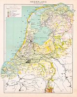 Vintage map Netherlands. GroundsStudio Wunderkammer
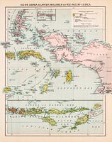 Vintage map Little Sunda Islands, Moluccas and New GuineaStudio Wunderkammer
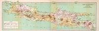 Vintage map of Java and MaduraStudio Wunderkammer
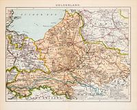 Vintage map Province of Gelderland ca. 1900Studio Wunderkammer
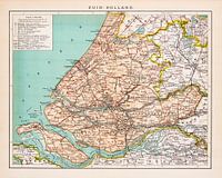 Vintage map Province of South - Holland ca. 1900Studio Wunderkammer
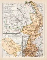 Vintage map Province of Limburg ca. 1900Studio Wunderkammer
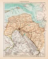 Vintage map Province of Groningen ca. 1900Studio Wunderkammer
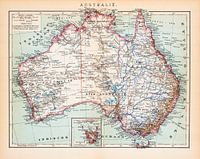 Australia. Vintage card ca. 1900Studio Wunderkammer
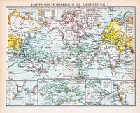 World map of explorations. Vintage map ca. 1900Studio Wunderkammer
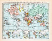 World map, colonies of Europe. Vintage map ca. 1900Studio Wunderkammer
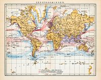 Sea currents, world map. Vintage map ca. 1900Studio Wunderkammer
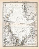 North Sea, sea chart. Vintage map ca. 1900Studio Wunderkammer


