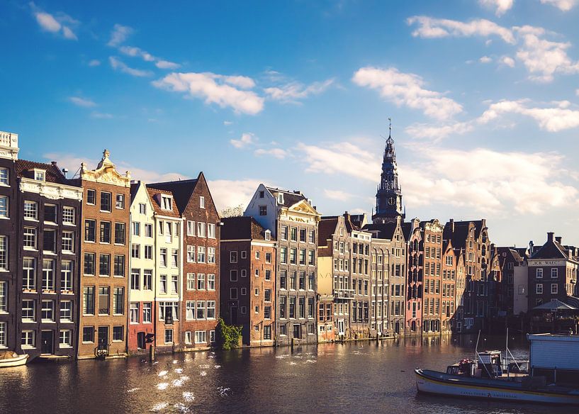


Buy the photo The Damrak in Amsterdam - Oude Kerk Amsterdam by Nicky Kapel on canvas, ArtFrame, poster and wallpaper, printed on demand in high quality.
About "The Damrak in Amsterdam - Oude Kerk Amsterdam"
by Nicky Kapel
About the artwork
The Damrak in Amsterdam is a street and water between Dam Square and Central Station.
History
Originally, the Damrak was the name of the straight stretch (A 'rak' is a straight stretch of canal) of the Amstel River between the Plaetse (the name of today's Dam until the early 17th century) and the IJ. Via a lock at the Plaetse, the water flowed from the Rokin into the Damrak and then emptied into the IJ. Here was part of Amsterdam's old harbour. Where Central Station is now, there was a row of mooring posts in the IJ, where larger ships could moor. The quay, which only runs on one side of the water, was called "Op 't Water" until the demolition of southern parts of the Damrak, between Dam and Oudebrugsteeg, in 1845 and in 1883. Between 1845 and 1903, Zocher's Stock Exchange stood where the Bijenkorf now stands.
The houses on Warmoesstraat between Nieuwebrugsteeg and Oudebrugsteeg still stand with their rear façades in the undammed part of Damrak. Near Guldehandsteeg, which connects the water to Warmoesstraat, this row of gables still contains the only remaining waterfront pavement, where ships were unloaded. In this remaining part of the water (the "Wet Damrak") tour boats moor.
Two bridges over the Damrak, the Papenbrug (near the Oude Kerk) and the Oude Brug, disappeared when they were filled in (the Papenbrugsteeg and Oudebrugsteeg still remind us of them). The Nieuwe Brug (bridge no. 303) lies where the Prins Hendrikkade crosses the Damrak. A lock, the Nieuwe Brugsluis, is also located here. (Source: Wikipedia)

About Nicky Kapel
Nicky Kapel, independent photographer based in Elst Gelderland. My interests are mainly nature, landscape and environmental photography. More Information or photos from me can be found on my Instagram http://bit.do/NickyKapel.
Photography & editing
Canon 7D - Apple
Adobe Lightroom - Adobe Photoshop..
Read more…
 Amsterdam
 Old church
 Photo wallpaper
 Photography
 Reflections
 Serene Peace
 Towns
Towns Water
Water Germany
 Ordered in November 2019
 Netherlands
 Ordered in July 2024
Germany
Ordered in March 2024
Germany
Ordered in April 2022
Germany
Ordered in June 2020
Netherlands
Ordered in July 2018
Germany
Ordered in August 2019
Germany
Ordered in November 2019
Germany
Ordered in December 2023
Netherlands
Ordered in August 2019
Germany
Ordered in December 2024
Netherlands
Ordered in December 2021
Ordered in July 2024
Germany
Ordered in March 2024
Germany
Ordered in April 2022
Germany
Ordered in June 2020
Netherlands
Ordered in July 2018
Germany
Ordered in August 2019
Germany
Ordered in November 2019
Germany
Ordered in December 2023
Netherlands
Ordered in August 2019
Germany
Ordered in December 2024
Netherlands
Ordered in December 2021
About the material
ArtFrame™
Interchangeable Art Prints
- High-quality print
- Easily interchangeable
- Acoustic function
- Large sizes available


Discover the artworks of Nicky Kapel
 SunsetNicky Kapel
 Rijnkade ArnhemNicky Kapel
 Sparta Stadium "The Castle "Nicky Kapel
 Sunset over Elst (Gld)Nicky Kapel
 Elst (Gld)Nicky Kapel
 Grote Kerk Elst (Gld)Nicky Kapel
 Waalkade Nijmegen by NightNicky Kapel
 Waalkade Nijmegen by Night - black and whiteNicky Kapel
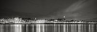 Waalkade Nijmegen by Night - Panorama - Black and whiteNicky Kapel
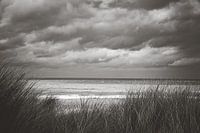 Zandvoort by the SeaNicky Kapel
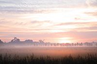 Foggy sunrise ElstNicky Kapel
 The Scottish HighlanderNicky Kapel
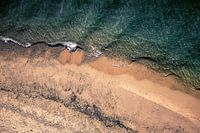 Waalbeach NijmegenNicky Kapel
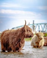 Scottish Highlander with Nijmegen as background.Nicky Kapel
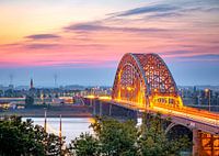 The Waal bridge at NijmegenNicky Kapel
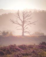 Sunrise on the Posbank (dead tree)Nicky Kapel
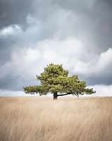 Scots pine on the Terletse HeideNicky Kapel
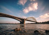 Waal bridge Nijmegen (arch bridge)Nicky Kapel
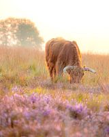 https://www.google.com/search?client=safari&rls=en&q=Grazing+Scots+highlander&ie=UTF-8&oe=UTF-8Nicky Kapel
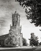 Tower of Elst in black and whiteNicky Kapel


