


Buy this of Rotterdam Noordeiland and Nieuwe Maas, early in the morning by Frans Blok - photos, art and other wall decoration on canvas, ArtFrame, poster and wallpaper, printed on demand in high quality.
About "Noordeiland and Nieuwe Maas, early in the morning"
by Frans Blok - photos, art and other wall decoration
About the artwork
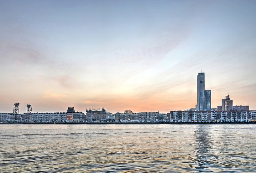
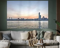
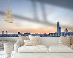
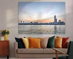
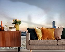
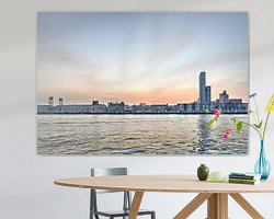
The Noordereiland (North Island) in Rotterdam is situated between the Nieuwe Maas river and the Koningshaven (the King's Harbour) . By digging the latter waterway in 1874, the area became an island, which then quickly filled up with urban expansion.
A large part of the buildings on the island is pre-war but the eastern and western part were so badly damaged during the fighting in May 1940 that the buildings here are more recent (at the right in the picture)
Left in the background, we see the Hef, the former railway bridge across the Koningshaven; right we see the Maas Tower and some other new buildings on the Southbank.
About Frans Blok - photos, art and other wall decoration
My work can be found in the border regions of photography, painting and computer visuals. With my company 3Develop I do work in commission but I use the same techniques, skills and software to make free work.
World maps and reliefs made from unique materials, vintage postcards,..
Read more…
 Feyenoord
 New Maas
 North Island
 Photo wallpaper
 Photography
 Rotterdam
 Serene Peace
 Sunrise
 The Hef
 Water
Water Germany
 Ordered in April 2025
Germany
Ordered in May 2020
Germany
Ordered in April 2021
Germany
Ordered in August 2025
Ordered in April 2025
Germany
Ordered in May 2020
Germany
Ordered in April 2021
Germany
Ordered in August 2025
 Netherlands
 Ordered in March 2023
Germany
Ordered in May 2021
Netherlands
Ordered in March 2023
Germany
Ordered in May 2021
Netherlands Ordered in May 2021
Germany
Ordered in August 2025
Netherlands
Ordered in August 2017
Netherlands
Ordered in November 2024
Netherlands
Ordered in January 2019
Netherlands
Ordered in April 2021
Ordered in May 2021
Germany
Ordered in August 2025
Netherlands
Ordered in August 2017
Netherlands
Ordered in November 2024
Netherlands
Ordered in January 2019
Netherlands
Ordered in April 2021
About the material
ArtFrame™
Interchangeable Art Prints
- High-quality print
- Easily interchangeable
- Acoustic function
- Large sizes available


Discover the artworks of Frans Blok - photos, art and other wall decoration
 One thousand wind turbine at seas - storm is comingFrans Blok - photos, art and other wall decoration
 November in Kralingen Forest, RotterdamFrans Blok - photos, art and other wall decoration
 Sunset Lake Kralingen, RotterdamFrans Blok - photos, art and other wall decoration
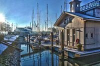 Veerhaven Rotterdam in WinterFrans Blok - photos, art and other wall decoration
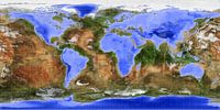 The Inverted WorldFrans Blok - photos, art and other wall decoration
 Old Harbour Rotterdam Around SunsetFrans Blok - photos, art and other wall decoration
 Rotterdam Skyline, reflected in the river Nieuwe MaasFrans Blok - photos, art and other wall decoration
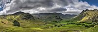 Panorama Lake District, EngelandFrans Blok - photos, art and other wall decoration
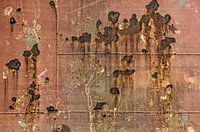 Ship hull with welds and rustFrans Blok - photos, art and other wall decoration
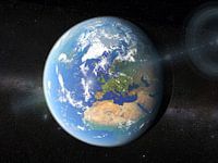 Earth from SpaceFrans Blok - photos, art and other wall decoration
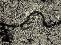 Light Map of RotterdamFrans Blok - photos, art and other wall decoration
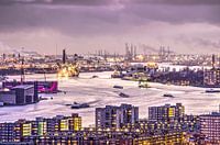 Rotterdam, the city, the river and the portFrans Blok - photos, art and other wall decoration
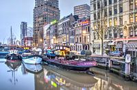 Rotterdam Wijnhaven, early morningFrans Blok - photos, art and other wall decoration
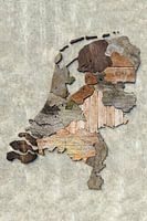 Scrapwood map of the NetherlandsFrans Blok - photos, art and other wall decoration
 Rotterdam skyline in greyscaleFrans Blok - photos, art and other wall decoration
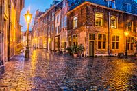 A rainy night in LeidenFrans Blok - photos, art and other wall decoration
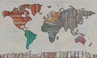 Scrapwood map of the worldFrans Blok - photos, art and other wall decoration
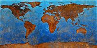 World Map RustFrans Blok - photos, art and other wall decoration
 World map rust - black versionFrans Blok - photos, art and other wall decoration
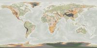 Japandi world mapFrans Blok - photos, art and other wall decoration


