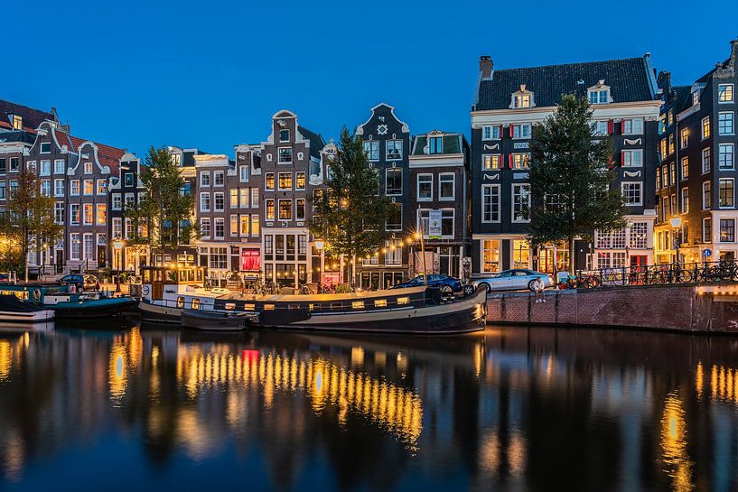


Buy the photo Night falls at the Amsterdam Singel by Jeroen de Jongh Photography on canvas, ArtFrame, poster and wallpaper, printed on demand in high quality.
About "Night falls at the Amsterdam Singel"
by Jeroen de Jongh Photography
About the artwork
The Singel is an Amsterdam canal, running from the IJ to the Muntplein, where it flows into the Binnen Amstel.
The Singel was dug from the IJ to the Boerenwetering around 1428. The remaining part to the Amstel followed around 1450. Until the city enlargement of about 1585, the Singel formed the western city boundary. From 1481, the earthen wall was replaced by a stone wall. At that time, the Singel was also called Stedegracht.
In the 17th century, the Singel was temporarily called Koningsgracht in honour of King Henry IV of France, an important ally of the Republic at the time. Koningsplein is a reminder of this. The part of the Singel from the Round Lutheran Church to Lijnbaanssteeg where the ships bound for London, the 'Londoners', had their berths, was also called London Quay and English Quay.
The Torensluis lock from 1648 is the oldest preserved and the widest bridge in the entire inner city. This Bridge 9 - at the level of Oude Leliestraat - is so wide because the Jan Roodenpoort tower, demolished in 1829, stood here. The tower's dungeons are still part of the bridgehead. In the cobbles on the bridge, the contours of the former tower have been made recognisable since 2003.
The Muntsluis under Muntplein is the last bridge before the Singel flows into the Amstel. In the system of numbering Amsterdam's bridges, it is the first, bridge 1.
About Jeroen de Jongh Photography
I'm Jeroen, and I'll spare you the long introduction. ;) If you're looking for a landscape photo for your wall, you've come to the right place... Read more…
 Amsterdam
 Blue hour
 Canal house
 Europe
 North Holland
 Photo wallpaper
 Photography
 Reflections
 Romantic Moments
 Serene Peace
 Singels
 The Netherlands
 Netherlands
 Ordered in September 2019
Netherlands
Ordered in September 2022
Ordered in September 2019
Netherlands
Ordered in September 2022
 Germany
 Ordered in August 2019
Netherlands
Ordered in August 2019
Netherlands Ordered in February 2025
Germany
Ordered in November 2020
Germany
Ordered in March 2021
Germany
Ordered in November 2021
Germany
Ordered in December 2019
Netherlands
Ordered in June 2019
Ordered in February 2025
Germany
Ordered in November 2020
Germany
Ordered in March 2021
Germany
Ordered in November 2021
Germany
Ordered in December 2019
Netherlands
Ordered in June 2019
 Netherlands
Ordered in November 2021
Germany
Ordered in July 2020
Netherlands
Ordered in November 2019
Netherlands
Ordered in November 2021
Germany
Ordered in July 2020
Netherlands
Ordered in November 2019
About the material
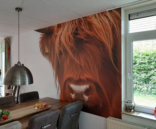
ArtFrame™
Interchangeable Art Prints
- High-quality print
- Easily interchangeable
- Acoustic function
- Large sizes available


Discover the artworks of Jeroen de Jongh Photography
 Full moon at the flower marketJeroen de Jongh Photography
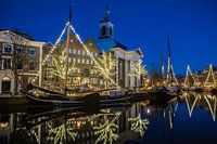 Lange HavenJeroen de Jongh Photography
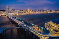 Scheveningen PierJeroen de Jongh Photography
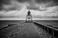 Lighthouse StavorenJeroen de Jongh Photography
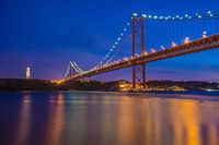 April 25th BridgeJeroen de Jongh Photography
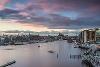 OosterdokJeroen de Jongh Photography
 Climb to the lightJeroen de Jongh Photography
 MonnickendamJeroen de Jongh Photography
 Zonnepad MonnickendamJeroen de Jongh Photography
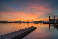 NDSM sunsetJeroen de Jongh Photography
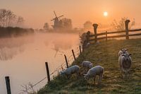 Mill de Vlinder on a misty morning in the BetuweJeroen de Jongh Photography
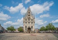 Town Hall of Gouda at the MarketJeroen de Jongh Photography
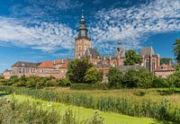 Swans at the skyline of ZutphenJeroen de Jongh Photography
 Quiet autumn morning in the park of Groeneveld CastleJeroen de Jongh Photography
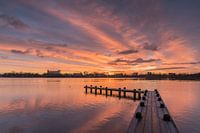 Magical sunrise at the Amstelveense PoelJeroen de Jongh Photography
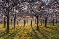 Sunrise in the cherry blossom park of the Amsterdamse BosJeroen de Jongh Photography
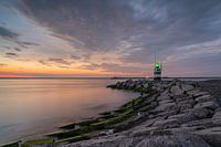 Sunset at the IJmuiden PierJeroen de Jongh Photography
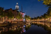 Peace and quiet at Schiedam's Lange HavenJeroen de Jongh Photography
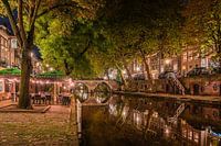 Having a drink along Utrecht's Oudegracht canalJeroen de Jongh Photography
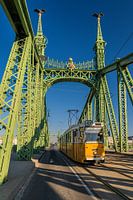 Tram 47 passes over the Freedom Bridge in BudapestJeroen de Jongh Photography


