


Buy the photo Kloveniersburgwal by Jeroen de Jongh Photography on canvas, ArtFrame, poster and wallpaper, printed on demand in high quality.
About "Kloveniersburgwal"
by Jeroen de Jongh Photography
About the artwork
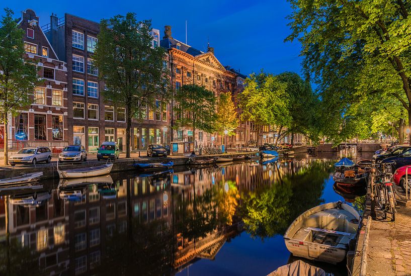
The Kloveniersburgwal is an Amsterdam canal, between the Nieuwmarkt and the Amstel River, east of Dam Square in Amsterdam-Centre.
The Kloveniersburgwal was dug at the end of the 15th century, from the Sint Antoniespoort (now Waag on the Nieuwmarkt) to the south, where it ended up on the Amstel river. On the city side (the west side) a city wall was built, with three small wall towers and the large wall tower: Swych Utrecht (1481). On the wall bordered mainly gardens and orchards, and the Bethaniënklooster. The bird's-eye view map of Cornelis Anthonisz. from 1544 shows this clearly. With the Geldersekade and the Singel, the Kloveniersburgwal formed the city canal around the city.
After the Nieuwe Gracht (the present Oudeschans) was dug and new city walls were constructed, the Kloveniersburgwal lost its function as a defensive moat. The old city wall was demolished and houses were built.
During the Second World War - from February 1941 onwards - the Kloveniersburgwal was the border of the Jewish quarter closed off by the Germans. In the 'Jodenhoek' (Jewish Corner) between Central Station, the Kloveniersburgwal, Waterlooplein, Valkenburgerstraat and Prins Hendrikkade lived, besides non-Jews, more than 25,000 Jews.
About Jeroen de Jongh Photography
I'm Jeroen, and I'll spare you the long introduction. ;) If you're looking for a landscape photo for your wall, you've come to the right place... Read more…
 Amsterdam
 Blue hour
 Canal house
 City centre of Amsterdam
 Photo wallpaper
 Photography
 Reflections
 Romantic Moments
 Serene Peace
 The Netherlands
 Germany
 Ordered in January 2021
 Netherlands
 Ordered in October 2024
Netherlands
Ordered in April 2025
Netherlands
Ordered in October 2024
Netherlands
Ordered in April 2025
Netherlands Ordered in November 2021
Germany
Ordered in September 2019
Germany
Ordered in November 2023
Germany
Ordered in June 2020
Netherlands
Ordered in September 2025
Netherlands
Ordered in October 2020
Germany
Ordered in August 2019
Germany
Ordered in January 2021
Netherlands
Ordered in April 2021
Ordered in November 2021
Germany
Ordered in September 2019
Germany
Ordered in November 2023
Germany
Ordered in June 2020
Netherlands
Ordered in September 2025
Netherlands
Ordered in October 2020
Germany
Ordered in August 2019
Germany
Ordered in January 2021
Netherlands
Ordered in April 2021
About the material
ArtFrame™
Interchangeable Art Prints
- High-quality print
- Easily interchangeable
- Acoustic function
- Large sizes available


Discover the artworks of Jeroen de Jongh Photography
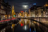 Full moon at the flower marketJeroen de Jongh Photography
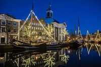 Lange HavenJeroen de Jongh Photography
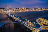 Scheveningen PierJeroen de Jongh Photography
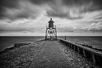 Lighthouse StavorenJeroen de Jongh Photography
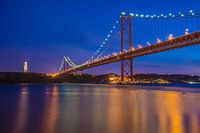 April 25th BridgeJeroen de Jongh Photography
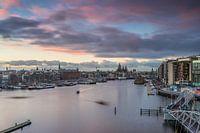 OosterdokJeroen de Jongh Photography
 Climb to the lightJeroen de Jongh Photography
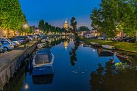 MonnickendamJeroen de Jongh Photography
 Zonnepad MonnickendamJeroen de Jongh Photography
 NDSM sunsetJeroen de Jongh Photography
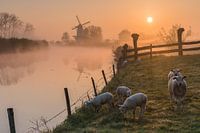 Mill de Vlinder on a misty morning in the BetuweJeroen de Jongh Photography
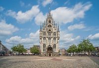 Town Hall of Gouda at the MarketJeroen de Jongh Photography
 Swans at the skyline of ZutphenJeroen de Jongh Photography
 Quiet autumn morning in the park of Groeneveld CastleJeroen de Jongh Photography
 Magical sunrise at the Amstelveense PoelJeroen de Jongh Photography
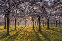 Sunrise in the cherry blossom park of the Amsterdamse BosJeroen de Jongh Photography
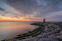 Sunset at the IJmuiden PierJeroen de Jongh Photography
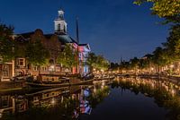 Peace and quiet at Schiedam's Lange HavenJeroen de Jongh Photography
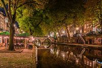 Having a drink along Utrecht's Oudegracht canalJeroen de Jongh Photography
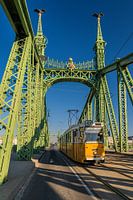 Tram 47 passes over the Freedom Bridge in BudapestJeroen de Jongh Photography


