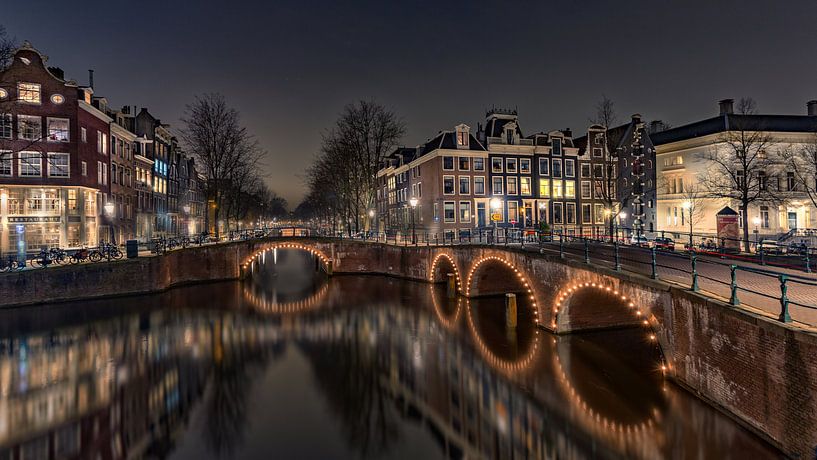


Buy the photo Keizersgracht Amsterdam by Michael van der Burg on canvas, ArtFrame, poster and wallpaper, printed on demand in high quality.
About "Keizersgracht Amsterdam"
by Michael van der Burg
About the artwork
The Keizersgracht, the second of Amsterdam's three main canals that make up the ring of canals, lies between Herengracht and Prinsengracht The first part of the Keizersgracht (between Brouwersgracht and (approximately) today's Leidsegracht was dug in the summer of 1615 on the initiative of mayor Frans Hendricksz. Oetgens, city carpenter Hendrick Jacobsz Staets and city land surveyor Lucas Jansz Sinck. The Keizersgracht, named after Emperor Maximilian I of the Holy Roman Empire,[1] is the widest canal in the centre of Amsterdam, namely one hundred Amsterdam feet, i.e. 28.31 metres. In September 1614, there was still an idea to turn the Keizersgracht into a chic boulevard without water, following the example of the Voorhout in The Hague. This was abandoned for a few reasons. The vroedschap suspected that future buyers of plots on Keizersgracht wanted to be able to reach their homes or warehouses by boat. Other considerations may have included the need for water storage, easier transportation of building and embankment materials, but especially the shortage of embankment material. The construction of the fortifications also required a lot of embankment material at the same time. In November 1615, the allotment on the east side was completed. At 30 feet, the plots were given the same width as at Herengracht. Building proceeded rapidly: by 1618, there were hardly any undeveloped plots. The section between Leidsegracht and Amstel belonged to the fourth expansion (1658). In
About Michael van der Burg
Welcome!.. Read more…
 Classic
 Photo wallpaper
 Photography
 Reflections
 Romantic Moments
 Serene Peace
 Urban / Street
 Germany
 Ordered in April 2020
 Netherlands
 Ordered in June 2021
Netherlands
Ordered in November 2019
Netherlands
Ordered in October 2020
Germany
Ordered in December 2019
Netherlands
Ordered in June 2021
Netherlands
Ordered in November 2019
Netherlands
Ordered in October 2020
Germany
Ordered in December 2019
Netherlands Ordered in January 2025
Netherlands
Ordered in July 2017
Ordered in January 2025
Netherlands
Ordered in July 2017
 Netherlands
Ordered in November 2024
Germany
Ordered in September 2019
Germany
Ordered in September 2019
Netherlands
Ordered in January 2022
Germany
Ordered in August 2019
Netherlands
Ordered in November 2024
Germany
Ordered in September 2019
Germany
Ordered in September 2019
Netherlands
Ordered in January 2022
Germany
Ordered in August 2019
About the material
ArtFrame™
Interchangeable Art Prints
- High-quality print
- Easily interchangeable
- Acoustic function
- Large sizes available


Discover the artworks of Michael van der Burg
 Erasmus Bridge Evening from the WillemskadeMichael van der Burg
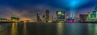 Rotterdam Panorama Rijnhaven ViewMichael van der Burg
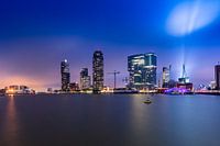 Skyline Rotterdam Rijnhaven viewMichael van der Burg
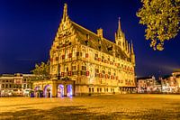 Gouda Town Hall rear viewMichael van der Burg
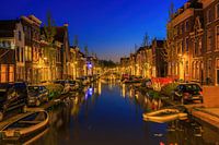 Turfmarkt GoudaMichael van der Burg
 West and Oosthaven GoudaMichael van der Burg
 B&W Erasmus bridge LeuvehoofdMichael van der Burg
 Erasmus BridgeMichael van der Burg
 Singel Red Light DistrictMichael van der Burg
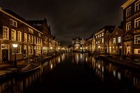 Old Rhine LeidenMichael van der Burg
 Leiden American Pilgrim MuseumMichael van der Burg
 Koppelpoort Sunset AmersfoortMichael van der Burg
 reflection KinderdijkMichael van der Burg
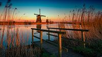 Kinderdijk HollandMichael van der Burg
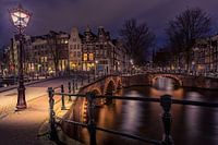 Keizersgracht AmsterdamMichael van der Burg
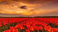 Tulips Sunset HollandMichael van der Burg
 Behind the Church DelftMichael van der Burg
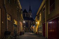 Trompetsteeg DelftMichael van der Burg
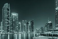 Dubai Marina 2.0Michael van der Burg
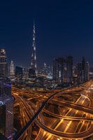 Burj Khalifa MagicalMichael van der Burg


