


Buy this landscape artwork Hiking in the Wetterau by Thomas Riess on canvas, ArtFrame, poster and wallpaper, printed on demand in high quality.
About "Hiking in the Wetterau"
by Thomas Riess
About the artwork
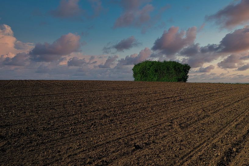
Hiking in the Wetterau in spring. Today, the Wetterau is considered to be the area north of Frankfurt am Main, east of the Taunus and south-west of the Vogelsberg. The southern boundary is roughly the Hohe Straße (Berger Rücken). The main part of this landscape is taken up by the Wetterau district (district town of Friedberg). Its namesake is the river Wetter, but apart from its tributaries such as the Usa, it is also crossed by its receiving watercourse Nidda and other tributaries, in particular the Horloff and the Nidder; in this respect the name is somewhat misleading. The landscape ultimately encompasses a large part of the catchment area of the Nidda, which rises in the Vogelsberg and flows into the Main between Frankfurt-Nied and Frankfurt-Höchst. The eponymous Wetter flows into the Nidda at Niddatal-Assenheim.

About Thomas Riess
Amateur photographer with advanced knowledge, retired for 6 years. Made my first experiences with photography as an employee at CANON and now, after many stations, take photos digitally with the Pentax K1 MK II and various lenses. My main focus is difficult to define. .. Read more…
 Clouds
 Desert
 Farm
Farm Landscapes
 Meadow
 Photo wallpaper
 Photography
 Play of Light
 Serene Peace
 Netherlands
 Ordered in December 2016
Netherlands
Ordered in October 2017
Ordered in December 2016
Netherlands
Ordered in October 2017
 Netherlands
Ordered in May 2021
Netherlands
Ordered in August 2020
Netherlands
Netherlands
Ordered in May 2021
Netherlands
Ordered in August 2020
Netherlands Ordered in July 2025
Netherlands
Ordered in October 2017
Ordered in July 2025
Netherlands
Ordered in October 2017
 Germany
 Ordered in December 2021
Germany
Ordered in September 2021
Germany
Ordered in November 2024
Germany
Ordered in March 2020
Germany
Ordered in June 2019
Germany
Ordered in April 2021
Ordered in December 2021
Germany
Ordered in September 2021
Germany
Ordered in November 2024
Germany
Ordered in March 2020
Germany
Ordered in June 2019
Germany
Ordered in April 2021
About the material
ArtFrame™
Interchangeable Art Prints
- High-quality print
- Easily interchangeable
- Acoustic function
- Large sizes available


Discover the artworks of Thomas Riess
 Flower meadowThomas Riess
 Brothers GrimmThomas Riess
 Gingko in the sunThomas Riess
 source of lifeThomas Riess
 sweeping inThomas Riess
 To a glass of wineThomas Riess
 at the cemetery in FrankfurtThomas Riess
 The day endsThomas Riess
 Kugelbake in CuxhavenThomas Riess
 Bench on dikeThomas Riess
 No bathing weatherThomas Riess
 Relaxation at WalchenseeThomas Riess
 Illuminating the darknessThomas Riess
 Forest walk monochromeThomas Riess
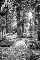 Towards the sunThomas Riess
 On the last roadThomas Riess
 Towards the sunThomas Riess
 Memorial stone at Frankfurt's main cemeteryThomas Riess
 Historic old town in East FrisiaThomas Riess
 In the centre of the Trastevere districtThomas Riess


