


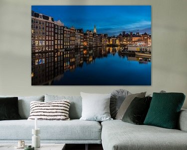


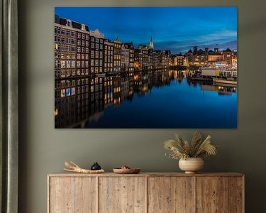


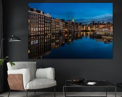
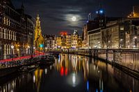
Buy the photo Damrak in the evening by Jeroen de Jongh Photography on canvas, ArtFrame, poster and wallpaper, printed on demand in high quality.
About "Damrak in the evening"
by Jeroen de Jongh Photography
About the artwork
The Damrak in Amsterdam is a street and a water between Dam Square and Central Station.
Originally the Damrak was the part of the river Amstel between the Dam and the IJ. Via a lock at the Dam the river flowed from the Rokin into the Damrak and then flowed into the IJ. This was part of the old port of Amsterdam. Where Central Station is now located, there was a row of bollards in the IJ, to which larger ships could moor. The quay, which only runs on one side of the water, was called "Op 't Water" until the second half of the 19th century. In the 19th century southern parts of the Damrak were filled in. Between 1845 and 1903, where the Beehive now stands, stood the Beurs van Zocher.
The Damrak is part of the route that should give the traveller a first impression of the city after leaving the station. This route, which is called the 'Red Carpet', runs from the Central Station over the Rokin, the Muntplein, the Vijzelstraat/gracht to the Weteringcircuit. At the Damrak there are many tourism-oriented shops, hotels, and (fast food) restaurants. Several alleys connect the Damrak with the parallel busy shopping street the Nieuwendijk. On the cushioned part of the Damrak, at the Beursplein, are the Beurs van Berlage, the Stock Exchange and De Bijenkorf.
About Jeroen de Jongh Photography
I'm Jeroen, and I'll spare you the long introduction. ;) If you're looking for a landscape photo for your wall, you've come to the right place... Read more…
 Amsterdam
 Blue hour
 Canal house
 City centre of Amsterdam
 Europe
 North Holland
 Old church
 Photo wallpaper
 Photography
 Reflections
 Romantic Moments
 Serene Peace
 The Netherlands
 Netherlands
 Ordered in May 2025
Netherlands
Ordered in October 2023
Netherlands
Ordered in March 2024
Netherlands
Ordered in May 2025
Netherlands
Ordered in October 2023
Netherlands
Ordered in March 2024
Netherlands Ordered in May 2021
Netherlands
Ordered in November 2020
Ordered in May 2021
Netherlands
Ordered in November 2020
 Germany
 Ordered in July 2025
Germany
Ordered in March 2019
Netherlands
Ordered in April 2019
Netherlands
Ordered in September 2020
Netherlands
Ordered in July 2024
Germany
Ordered in February 2019
Netherlands
Ordered in May 2021
Ordered in July 2025
Germany
Ordered in March 2019
Netherlands
Ordered in April 2019
Netherlands
Ordered in September 2020
Netherlands
Ordered in July 2024
Germany
Ordered in February 2019
Netherlands
Ordered in May 2021
About the material
ArtFrame™
Interchangeable Art Prints
- High-quality print
- Easily interchangeable
- Acoustic function
- Large sizes available


Discover the artworks of Jeroen de Jongh Photography
 Full moon at the flower marketJeroen de Jongh Photography
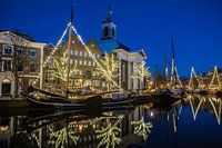 Lange HavenJeroen de Jongh Photography
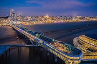 Scheveningen PierJeroen de Jongh Photography
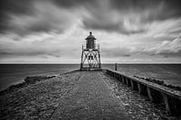 Lighthouse StavorenJeroen de Jongh Photography
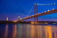 April 25th BridgeJeroen de Jongh Photography
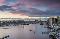 OosterdokJeroen de Jongh Photography
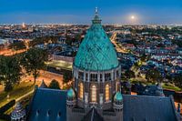 Climb to the lightJeroen de Jongh Photography
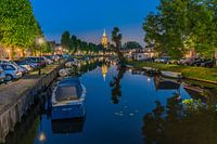 MonnickendamJeroen de Jongh Photography
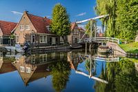 Zonnepad MonnickendamJeroen de Jongh Photography
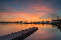 NDSM sunsetJeroen de Jongh Photography
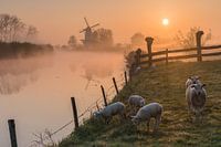 Mill de Vlinder on a misty morning in the BetuweJeroen de Jongh Photography
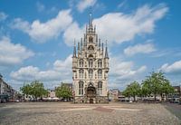 Town Hall of Gouda at the MarketJeroen de Jongh Photography
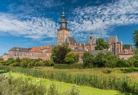 Swans at the skyline of ZutphenJeroen de Jongh Photography
 Quiet autumn morning in the park of Groeneveld CastleJeroen de Jongh Photography
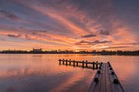 Magical sunrise at the Amstelveense PoelJeroen de Jongh Photography
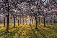 Sunrise in the cherry blossom park of the Amsterdamse BosJeroen de Jongh Photography
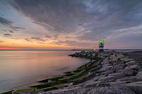 Sunset at the IJmuiden PierJeroen de Jongh Photography
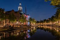 Peace and quiet at Schiedam's Lange HavenJeroen de Jongh Photography
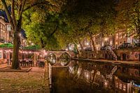 Having a drink along Utrecht's Oudegracht canalJeroen de Jongh Photography
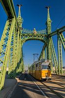 Tram 47 passes over the Freedom Bridge in BudapestJeroen de Jongh Photography


